
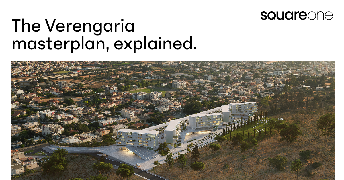
The Verengaria masterplan, explained
Verengaria is 260,000 m2 of state-owned land in Kato Polemidia, empty since 1998. The plans on file turn it into a university campus, research buildings, public schools, a town hall and a public park. Nothing has been built yet. Here is what the documents say, what changed between versions, and what a buyer in the area should do with the information.
What is Verengaria?
The British Forces built the Verengaria settlement in 1954 to house troops and their families. It came with its own roads, services and amenities, so it worked as a small town rather than a barracks. The site covers 260,000 m2 next to the historic core of Kato Polemidia, a short distance from the Paphos to Nicosia highway.
You will see the name written both ways. The British spelled it Berengaria. Greek took it as Βερεγγάρια, which transliterates back as Verengaria, and that is the spelling the planning documents use. Same place.
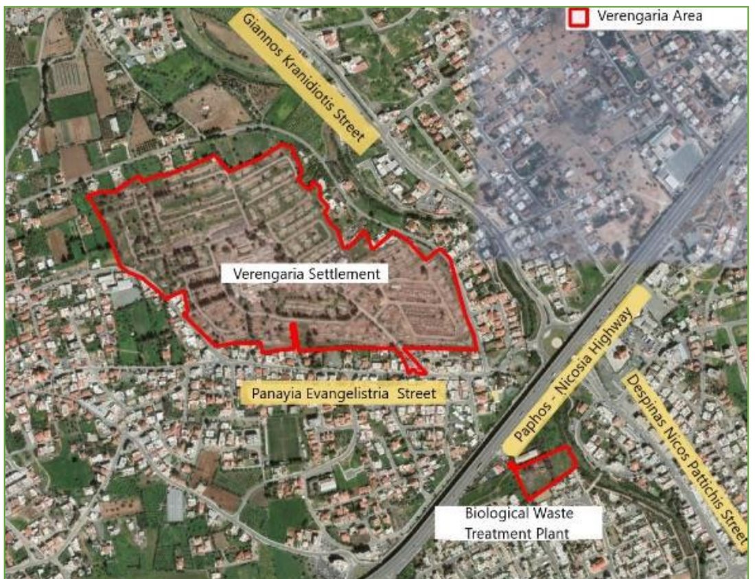
[Source: ALA Planning Partnership, Verengaria Masterplan case study, KAEBUP (Erasmus+).]
Why has it stood empty for a quarter of a century?
The British Government left the site in 1998. In 2001 an agreement between the Republic of Cyprus and the British Government transferred the land to the Republic. It has been classed as brownfield since: ground that was built on once and now sits unused.
Brownfield land moves slower than an empty field. Someone has to decide what replaces what was there, clear the old structures, and fund the replacement. Here that someone is the state. The decision came in 2018, when the Council of Ministers agreed to bring the area back into use.
What is planned for the site?
The Department of Town Planning and Housing drew a preliminary plan in October 2018. In January 2020 the Municipality of Kato Polemidia appointed ALA Planning Partnership to redraw it, with two aims: move the proposed uses into better positions, and build a road network on sustainable mobility principles, which means walking, cycling and public transport come before cars in the design.
The plan sets aside seven land uses:
- 73,700 m2 for Cyprus University of Technology: research labs, sports facilities and student housing
- 54,000 m2 for public schools
- 51,700 m2 of public open space
- 43,000 m2 for research and development buildings
- 7,100 m2 for a swimming pool and social facilities
- 6,300 m2 held for future uses
- 4,000 m2 for the Kato Polemidia town hall
Education and research take up roughly 45 per cent of the site. Open space takes another 20 per cent.
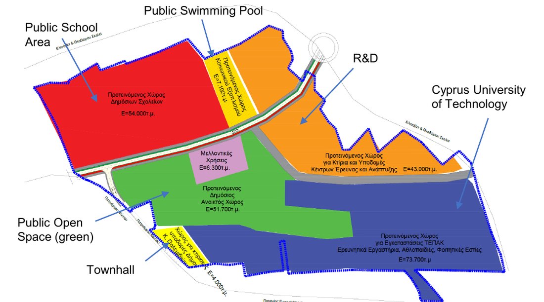
[Source: ALA Planning Partnership.]
How many times has the plan changed?
Three versions exist. The 2018 preliminary plan set out the same broad uses but shaped the roads around cars. The 2020 version moved the uses, ran walking and cycling routes through the site, and linked them to the Garyllis linear park. In December 2022 the Department of Town Planning and Housing kept the 2020 land uses, rearranged them, changed the road network again, and left out some of the 2020 proposals for community space and waste.
The useful reading for a buyer: the land uses have held steady since 2018. The road layout has not.
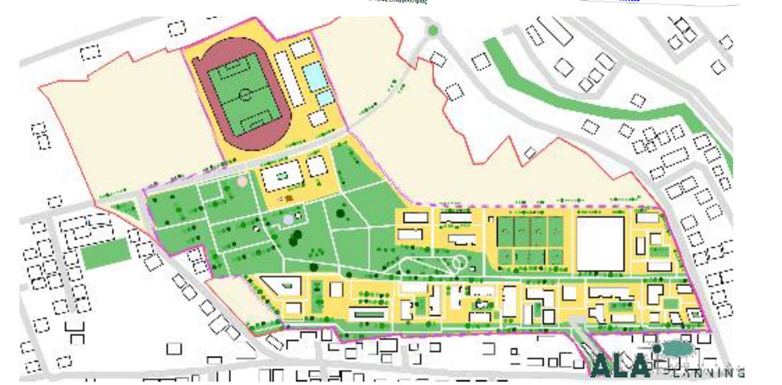
[Source: ALA Planning Partnership.]
Has anyone assessed the plan?
Yes, and the results are public. ALA Planning built a free assessment tool called STAMP with two research labs at the University of Cyprus. It scores a masterplan across 14 categories, among them vision, governance, health, mobility, air, climate, nature, water, waste, land use, construction and community. All three Verengaria versions were run through it.
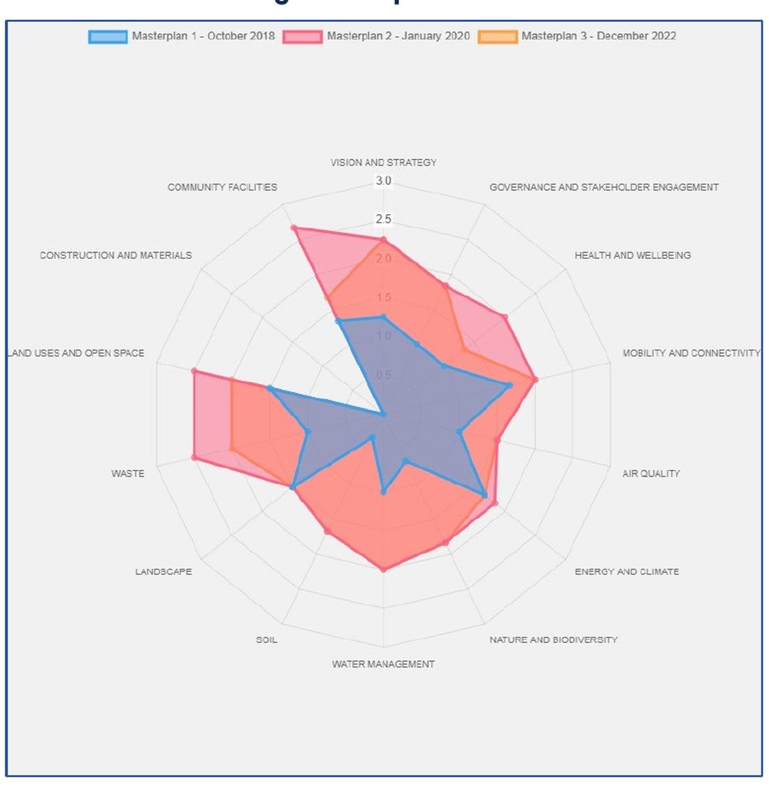
[Source: STAMP assessment, KAEBUP (Erasmus+).]
The 2020 version covers the widest area on the chart, so it scores best overall. The 2018 version scores lowest on vision, governance, mobility and biodiversity. The 2022 version matches 2020 on mobility but falls behind on community facilities, health, waste, and land uses and open space, because some 2020 proposals were not carried through. All three score zero on construction and materials. No version says how the buildings will be built, or from what.
What does a campus do to the streets around it?
Two tenant pools, on different clocks. Students, academic staff and researchers take homes within walking distance and renew every year. Families arrive for the schools, the pool and the open space, and they stay for years. A building that reaches both rents through the year and sells to two kinds of buyer later.
Shops follow people rather than plans. Cafes, groceries and services open once the first buildings fill, not when the drawings are signed. And the honest half: a site this size means construction traffic, noise and dust for years before any of the good parts arrive. This pattern repeats around new campuses. It is not a promise for Verengaria.
What should you check before you buy nearby?
- Price the property on what exists today: the building, the plot, the amenities, the drive to work. The campus is upside, not valuation.
- Ask who is obliged to build, and by when. No one is bound by a masterplan. A budget line and a tender are the signals that matter.
- Read the road layout in the current version before you assume a quiet street stays quiet. That is the part that keeps moving.
- Be wary of a seller who prices the campus in. You would be paying today for something the state may deliver in ten years.
We build here, so weigh the above accordingly. SquareOne's ZOIA sits in Verengaria, and those four questions are the ones we would want you to put to us.
See the area for yourself
Easier to judge an area on foot than on a map. ZOIA is under construction in Verengaria, Kato Polemidia. Ask for the price list, or walk the area with us.